
Cold blast crossing southeastern Australia
Weather warnings have been issued in parts of Tasmania and Victoria, with a cold front expected to bring low-level snow and damaging winds to some areas on Tuesday.
The cold front can be seen clearly in the satellite image below, marked by a band of cloud stretching from South Australia, across Victoria and Tasmania, and down over the Southern Ocean.
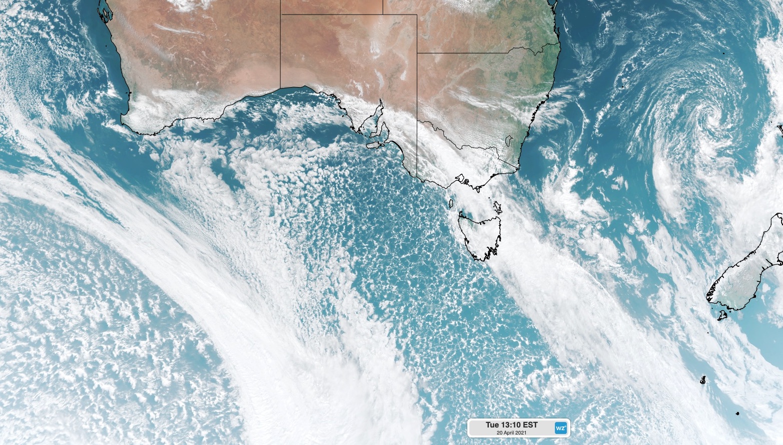
Image: Visible 'true colour' satellite image showing a cold front crossing southeastern Australia on Tuesday.
The large area of speckled clouds over the Bight reveals a big mass of cold air that's coming up from the Southern Ocean.
As the front moves towards the north and east on Tuesday, it will allow this cold air mass to spread across southeastern Australia.
In Tasmania, snow could reach down to 800 metres elevation as cold and blustery southwesterly winds blow over the state on Tuesday. These wintry conditions have prompted a Bush Walker's Weather alert for the state's Western and Central Plateau districts.
Across the Bass Strait, cold air will cause a blast of winter-like weather across Victoria, featuring rain, snow, small hail and blustery winds.
Snow could fall to 1100 metres above sea level in Victoria today, while damaging winds are also possible in the state's Alpine areas above 1200 metres.
After reaching 18.7ºC shortly before 11am, the change blew through Melbourne and had the temperature down to 12ºC before 1pm. Wind chill made it feel even colder, feeling ower than 10ºC at times.
Calmer weather will return on Wednesday before another, weaker front clips southeastern Australia on Thursday, bringing another burst of wind and showers.