
Big waves approaching the east and west
Large swells and waves are approaching both the east and west coasts of Australia this week as two strong systems build over the open ocean.
Off the east coast, a strong and rapidly deepening Tasman Low will develop on Monday and Tuesday, directing powerful waves up the NSW coast. At this stage, waves look to reach 3.5-4.5m over beaches exposed to the south (like Bondi Beach), with the potential to exceed 5 metres. Over open water, significant wave heights look to peak around 7-8m by Wednesday off the Sydney Coast.
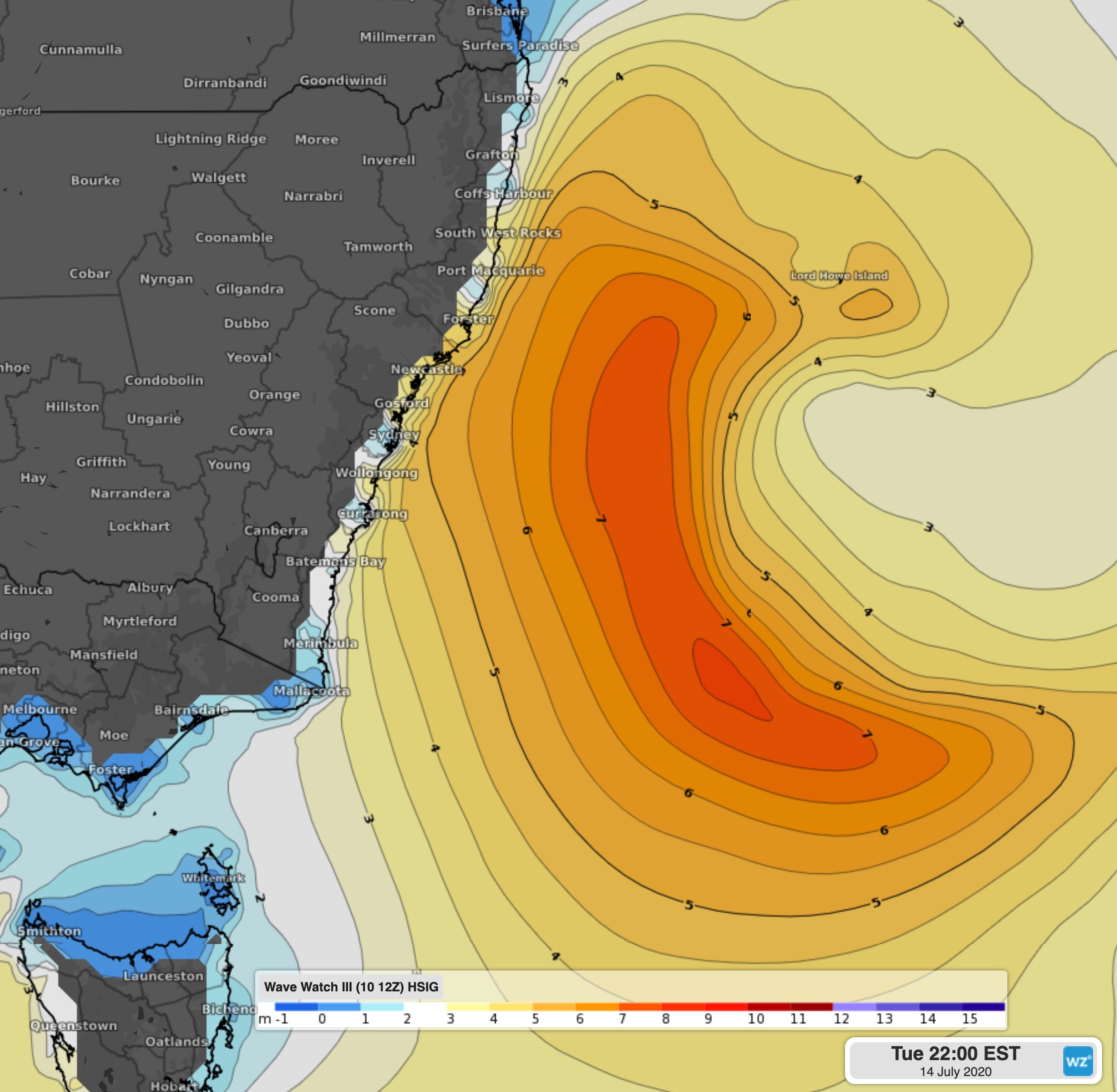
Image: Significant wave heights off the east coast on Tuesday night
Over in the west, a strong cold front and trough will approach the west coast on Monday night and Tuesday morning, generating large swells in addition to heavy showers, gusty winds, and thunderstorms as far north as Exmouth. Waves of around 4-5m look to crash into the exposed parts of the Western Australia coast (such as Rottnest Island) in a westerly swell, reaching around 3-4 metres at most beaches. Offshore significant wave heights look to peak around 7.5 metres over a broad area over waters to the southwest.
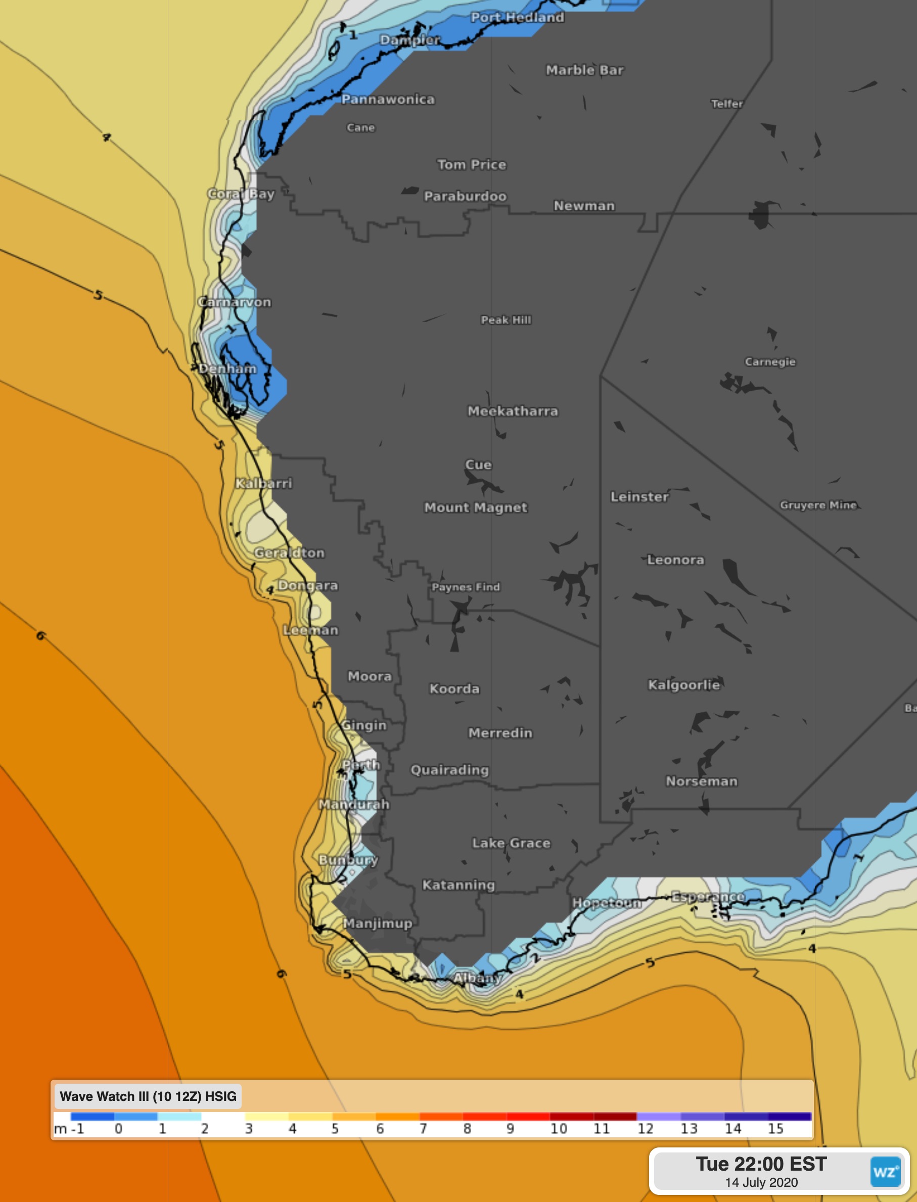
Image: Significant wave heights off the west coast on Tuesday night
With these powerful waves forecast, beach erosion will be quite prevalent, as well as choppy waters, making activities such as swimming and boating quite dangerous. Warnings could also be issued by the Bureau of Meteorology for hazardous or dangerous surf, so it's best to keep up to date at Weatherzone.com.