
Beautiful winter warmth in NSW
For the past week, the central east coast saw calm weather conditions due to a big high-pressure system passing over. Mostly sunny skies meant citizens could enjoy the best views of sunrise and sunset (without having to get up too early).
But these calm conditions also bring rise to dangerously foggy mornings and nights, as pockets of high humidity settle due to lack of winds (See our story: "Thick fog blankets parts of NSW").
Other record-breaking events associated with this calm winter weather are mild mornings. Sydney itself only dropped down to only 14.4 degrees, a minimum temperature so warm in the month of June not seen since 2016!
Here are some other monthly minimum records from today:
- Murrurundi Gap only dropped to 12.7 degrees, its highest June morning temperature since 2005
- Holsworthy only dropped to 11.9 degrees, its highest June morning temperature in the past 7 years
- Albury only dropped to 10.3 degrees, a first for June minima in the past 5 years
- Camden dropped to 9.8 & Campbelltown reached 10.6, June warm records going back to 2020
The clouds that have swept over the south and central coasts, with the passage of a trough, have locked in the morning heat, resulting in record high maximum temperatures for June too. Mascot made it up to 24.2 degrees, making it the warmest June day since 2004! Other records include:
- Gunnedah got up to 24.7 degrees, the highest June temperature in at least the past 69 years
- Cobar reached 27.3 degrees, its warmest June temperature since June 1962
- Trangie reached 25.3 degrees, its warmest June temperature in 47 years
- Camden got up to 24.8 degrees, the highest June temperature since 1976
Though cold minimums and warm maximums appear to form in two different weather systems (minimums commonly form in a high whilst maximums occur in a trough), it's not uncommon to see them pair up like this. In fact, nature has been hinting about this change to come for a few days now.
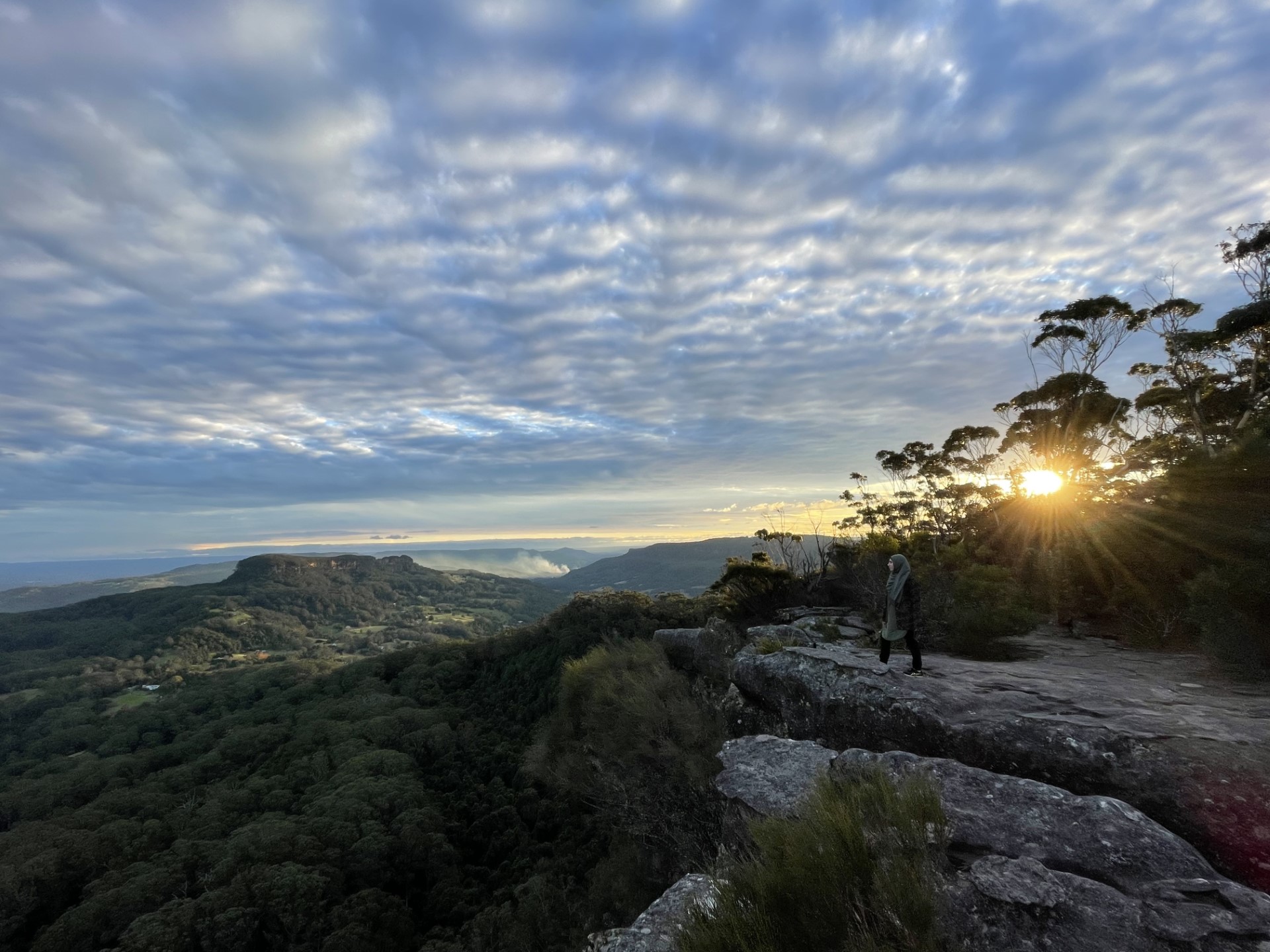
Cirrocumulus stratiformis clouds over Shoalhaven at 4:27pm on Wed 30th May
In the image above, we see a beautiful stretch of cirrocumulus stratiformis clouds. These clouds form high up in the troposphere (lowest layer of the atmosphere) and create a scaly pillow structure across the sky. They tend to form when the weather is fine, but indicate that in the days to come, poor conditions will follow, "predicting" the likely rain-to-come over the east coast late into this weekend.